


Bethel Bapt, Talladega County, Alabama
About
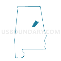
Outline

Summary
| Unique Area Identifier | 522950 |
| Name | Bethel Bapt |
| County | Talladega County |
| State | Alabama |
| Area (square miles) | 49.24 |
| Land Area (square miles) | 47.73 |
| Water Area (square miles) | 1.51 |
| % of Land Area | 96.94 |
| % of Water Area | 3.06 |
| Latitude of the Internal Point | 33.38277600 |
| Longtitude of the Internal Point | -86.30321240 |
Maps


Graphs
Select a template below for downloading or customizing gragh for Bethel Bapt, Talladega County, Alabama


Neighbors
Neighoring Voting District (by Name) Neighboring Voting District on the Map
- Harpersville City Hall, Shelby County, AL
- Limbaugh Comm Center-Bon Air- Oak Grove, Talladega County, AL
- Mabra-Kingston Bapt-Talla Co Central High, Talladega County, AL
- New London Fire Dept., St. Clair County, AL
- Renfroe Fire Hall -Stemley Fire Hall, Talladega County, AL
- Vincent City Hall, Shelby County, AL
- Winterboro Vol Fire-Gable's Corner Vol Fire, Talladega County, AL
Top 10 Neighboring County Subdivision (by Population) Neighboring County Subdivision on the Map
- Talladega CCD, Talladega County, AL (25,488)
- Pell City CCD, St. Clair County, AL (23,885)
- Childersburg CCD, Talladega County, AL (9,064)
- Vincent CCD, Shelby County, AL (5,165)
- Sycamore-Winterboro CCD, Talladega County, AL (4,742)
- Renfroe-Laniers CCD, Talladega County, AL (2,902)
Top 10 Neighboring Place (by Population) Neighboring Place on the Map
Top 10 Neighboring Unified School District (by Population) Neighboring Unified School District on the Map
- Shelby County School District, AL (170,473)
- Talladega County School District, AL (49,716)
- Pell City City School District, AL (27,712)
Top 10 Neighboring State Legislative District Lower Chamber (by Population) Neighboring State Legislative District Lower Chamber on the Map
- State House District 50, AL (55,378)
- State House District 33, AL (43,809)
- State House District 32, AL (38,800)
Top 10 Neighboring State Legislative District Upper Chamber (by Population) Neighboring State Legislative District Upper Chamber on the Map
- State Senate District 15, AL (160,461)
- State Senate District 12, AL (142,431)
- State Senate District 11, AL (125,111)
Top 10 Neighboring 111th Congressional District (by Population) Neighboring 111th Congressional District on the Map
Top 10 Neighboring Census Tract (by Population) Neighboring Census Tract on the Map
- Census Tract 113, Talladega County, AL (6,191)
- Census Tract 402.05, St. Clair County, AL (5,279)
- Census Tract 111, Talladega County, AL (4,742)
- Census Tract 103.02, Talladega County, AL (4,450)
- Census Tract 301.02, Shelby County, AL (4,127)
- Census Tract 112, Talladega County, AL (2,902)
- Census Tract 114, Talladega County, AL (2,873)